How Old Maps and Photographs Reveal a Building’s Past
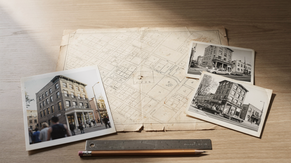
When I stand in front of a Georgian farmhouse with a mismatched wing and windows that don’t quite align, the first thing I reach for isn’t a ladder or a torch — it’s a folder of old maps and photographs. Fifteen years of valuing period homes taught me that the building itself tells only part of the story. The rest lies in cartographic evidence and photographic records, often tucked away in county archives or online catalogues, waiting to explain why a roofline dips, when a service wing vanished, or what that curious scar on the north elevation really means.
Old maps and photographs are some of the most practical tools for reconstructing a building’s history. Used together, they can show when a structure first appeared, how its footprint changed, what stood on the site before it, and which details were lost or altered over time. I’ve seen a single tithe map overturn decades of family lore about a house’s age, and a faded photograph from 1903 reveal original sash windows that three generations of owners had never known existed.
For anyone researching a historic house or estate in England, these sources are often the fastest route from vague curiosity to a credible timeline. They also help separate original fabric from later additions, which is essential if you are planning conservation work or simply trying to understand what you are looking at. The distinction matters: I’ve watched well-intentioned owners spend thousands “restoring” features that were never original, simply because they hadn’t checked the visual record first.
Why old maps and photographs matter
Maps and photographs answer different questions, and the researcher who relies on only one is working with half the evidence. I learned this the hard way early in my career, when I confidently dated a cottage to the 1840s based on its first appearance on an Ordnance Survey sheet — only to discover, through a photograph showing a date stone I’d missed, that the core was a century older and had simply been re-fronted.
- Maps show location, plot shape, street layout, access routes, outbuildings, boundaries, and later development around the property.
- Photographs show elevation, window patterns, roof forms, chimneys, porches, joinery, signage, materials, and landscape setting.
- Together, they help establish not just when a building existed, but how it changed.
That combination is especially useful when a house has been extended, refaced, divided, rebuilt after damage, or absorbed into a larger estate. In those cases, a single source rarely tells the full story. I once traced a Suffolk manor that had been “Georgianised” in the 1780s, Victorianised again in the 1860s, and stripped back in the 1920s — each layer legible only by cross-referencing maps showing footprint changes with photographs capturing the shifting architectural taste.
What old maps can tell you
Historic maps are often the backbone of building research. In England, Ordnance Survey maps are particularly useful because they can show development over time and help establish approximate construction dates. The six-inch and twenty-five-inch series, surveyed from the 1840s onward, offer remarkable precision — you can often identify individual outbuildings, wells, and even garden paths that have since disappeared under later paving or extensions.
What to look for on a map
- First appearance of the building footprint
- Changes in roofline or footprint between editions
- New wings, extensions, and rear service ranges
- Demolition of outbuildings, walls, or boundary features
- Changes in road alignment, drives, entrances, and access
- Field names, estate boundaries, and tithe references
- Relationship between the house and surrounding farmyard, garden, or parkland
I pay particular attention to rear service ranges and outbuildings. They’re easy to overlook when you’re focused on the main house, but they often contain the earliest surviving fabric on a site. A modest brick bakehouse or washhouse might predate the “period” farmhouse beside it by fifty years, and the map sequence will show you that if you’re watching for it.
A practical reading strategy
Start with the earliest map you can find, then move forward decade by decade. If a house appears on a later map but not on an earlier one, the gap narrows the likely construction period. If the footprint changes from one edition to the next, that often marks a major phase of alteration. I keep a simple timeline beside me as I work — map year on the left, observed change on the right — and the pattern of development usually becomes clear within an hour of systematic comparison.
Common map types and what they are good for
| Map type | Best use | Typical clue |
|---|---|---|
| Tithe maps | Pre-1840s land use and field boundaries | Estate layout and pre-urban landscape |
| Early Ordnance Survey maps | Building presence, plot shape, access, outbuildings | First appearance of the house and later additions |
| Estate maps | Private ownership and landscape design | Parkland, drives, ornamental features |
| Inclosure maps | Redistribution of land and boundaries | Shifts in ownership and access routes |
| Modern historic map overlays | Comparing change across periods | Loss of yards, gardens, walls, and outbuildings |
Tithe maps deserve special mention because they capture the English landscape just before the railway age transformed it. Drawn up in the 1830s and 1840s to record land ownership and tithe obligations, they often show field names, farm layouts, and building footprints with a level of detail that earlier county maps lack. I’ve used them to identify lost farmyards, trace the boundaries of medieval field systems, and confirm that a “period” cottage was actually a pair of labourers’ dwellings knocked together in the 1890s.
What old photographs reveal that maps cannot
A map can tell you that a bay was added. A photograph can show whether it was brick, stone, timber-framed, tile-hung, or simply a later refacing. Historic photographs are also invaluable for identifying decorative detail that has since been removed — the sort of evidence that no cartographer ever recorded and no deed ever described.
Photographic evidence can confirm
- Original window sash patterns
- Door surrounds and porches
- Chimney stacks and pots
- Roof coverings
- Joinery details
- Garden layouts and boundary treatments
- Former shopfronts, signage, and uses
- Damage from war, fire, or decay
- The original scale of a building before later redevelopment
Historic England notes that its archive holds millions of photographs, and the Historic England Archive is one of the key national resources for researching individual buildings. I’ve spent entire afternoons in their online catalogue, following a single building through a century of images — and the revelations come thick and fast when you compare a photograph from 1890 with one from 1920 and another from 1955.
Why photographs are especially useful for alterations
Buildings often survive in heavily altered form. A later replacement window or re-roof can hide what the house originally looked like. An old photograph may be the only record of features that were stripped out during mid-twentieth-century “modernisations” — a period when original joinery, chimney pieces, and even entire staircases were routinely removed.
Photographs can preserve evidence of:
- mullions removed in the twentieth century
- a lost conservatory
- a demolished veranda
- decorative ridge tiles
- earlier paint schemes or materials
- a now-absent service wing
I once worked with a couple restoring a Victorian villa in Cheltenham who had been told the original veranda was beyond recovery. A single photograph from a 1912 postcard, found in the local studies library, showed not only the veranda’s exact ironwork pattern but also the original colour scheme — pale cream with a deep green trim. That image guided a faithful reconstruction that would have been pure guesswork without the photographic evidence.
A step-by-step method for researching a building’s past
If you want a reliable result, do not jump straight to the most dramatic photograph you can find. Work methodically. I’ve seen too many building histories built on a single compelling image, only to unravel when the map evidence contradicted the assumed date. The sequence matters.
1. Define the building and its boundaries
Confirm the exact property, plot, and address history. Names and numbering often change over time, especially in towns and suburbs. If the house has been renamed or subdivided, use the map evidence to fix the site first. I’ve researched houses that have had four different names and three different street numbers in 150 years — without pinning down the plot first, you risk researching the wrong building entirely.
2. Find the earliest map evidence
Check whether the building appears on tithe maps, estate plans, or early Ordnance Survey sheets. Note:
- first appearance
- shape of the footprint
- relationship to roads and other buildings
- boundary lines
- any outbuildings or yard areas
3. Move forward through later map editions
Compare each edition in sequence. Look for additions and losses rather than only the main house. Small changes in rear ranges or boundary walls often reveal major shifts in use. A scullery added between 1880 and 1900 might signal the house’s transition from farm to middle-class residence; its demolition by 1950 might mark the arrival of indoor plumbing and a modern kitchen.
4. Search for photographs from different periods
Look for the building in archives, local collections, county record offices, library collections, and online image catalogues. The Historic England Archive and The National Archives are important starting points in England, while local archives often hold the most useful street-level and estate material. Don’t overlook postcard collections, family albums donated to local history societies, and the photographic surveys carried out by architectural historians in the early twentieth century.
5. Match the photograph to the map
This is where the research becomes convincing. A map may show a wing added by 1890, while a photograph may show the same wing in use by 1905. Matching both creates a timeline that is much stronger than either source alone. When I can place a photograph’s visible features onto a map’s documented footprint, I know I’m building a case that will stand up to scrutiny — whether from a conservation officer, a planning committee, or a sceptical owner.
6. Build a dated sequence
Record every clue in order:
- map year
- photograph date
- visible architectural change
- supporting source
- confidence level
This turns a pile of images into a usable building history. I use a simple spreadsheet, but even a handwritten chronology will do — the key is to make your reasoning visible, so that anyone reviewing your work can see which conclusions are firm and which are tentative.
How to read visual clues like a researcher
A good researcher looks for patterns, not just nice images. After years of examining buildings and their documentary records side by side, I’ve learned to watch for the small inconsistencies that signal alteration, repair, or loss.
Clues in maps
- Missing building on the earliest edition
- Slightly different footprint edges between revisions
- Sudden appearance of a service court or extension
- Rear structures shown only in later maps
- Drive relocation or new access road
- Formal garden replaced by subdivision or infill
Clues in photographs
- Inconsistent brick color or bond
- Change in roof pitch or ridge line
- Mismatched window proportions
- Former openings blocked up
- Extra chimneys or removed stacks
- Weathering lines showing former lean-tos
- Differences in stonework, render, or decorative trim
Clues that a building has been altered in phases
- One elevation looks more refined than another
- Windows do not align vertically
- Roof structure suggests different campaign dates
- Interior and exterior evidence conflict
- Rear elevation is more utilitarian than the front
These clues often point to a house that started small and was expanded as wealth, taste, or function changed. I’ve traced farmhouses that began as two-room cottages, gained a parlour wing in the Georgian period, acquired a service range in the Victorian era, and were finally “rationalised” with a linking extension in the twentieth century. Each phase left its mark in the maps and photographs, if you know where to look.
Typical mistakes to avoid
Many building histories go wrong because the evidence is read too quickly. I’ve made most of these mistakes myself at some point, and I see them repeated in well-meaning research all the time.
- Assuming the date of a map is the date of construction
- Confusing renovation with original form
- Ignoring later map editions
- Treating a photograph as proof of the first appearance of a feature
- Failing to check whether a building number or name changed
- Overlooking outbuildings, which often date earlier than the main house
- Using only one source instead of comparing map, photograph, and written record
A map shows what was recorded at the time the survey was made, not necessarily the exact year a wall was built. The same applies to photographs: they capture an instant, but not the full sequence behind it. I’ve seen a photograph from 1905 used to “prove” that a bay window was original, when in fact it had been added in 1903 — the photograph showed the finished result, not the construction date.
Best sources to check in England
National sources
- Historic England Archive for photographs, drawings, reports, and building records
- Historic England’s home-history guidance for maps, photos, and related resources
- The National Archives for architectural history records and related material
Local sources
- County record offices
- City and borough archives
- Local studies libraries
- Museum collections
- Estate archives
- Parish collections
- Local history societies
Local repositories are often the richest source for estate maps, tithe material, and building photographs tied to one place. I’ve found more useful material in a single afternoon at a county record office than in weeks of online searching — not because the online catalogues are poor, but because so much local material remains undigitised and uncatalogued in detail. The staff at these repositories are often deeply knowledgeable about their collections and can point you toward material you would never have thought to request.
A simple workflow for homeowners and researchers
Use this checklist when starting a new property investigation. I keep a printed copy in my research folder and tick off each item as I go — it prevents the temptation to skip steps when a particularly intriguing photograph appears.
Research checklist
- Confirm the exact address and historic names
- Gather all available map editions
- Note first appearance of the building
- Compare footprint changes across editions
- Collect photographs from different periods
- Match visible features to map evidence
- Record likely alteration phases
- Check written records for confirmation
- Separate facts from assumptions
- Keep source notes for every claim
When maps and photographs are not enough
Sometimes the visual record is incomplete. That is common with rural properties, modest buildings, or houses that were heavily altered before photography became widespread. I’ve researched cottages that appear on no map before 1880 and in no photograph before 1920 — yet their timber frames and brick infill clearly dated from the seventeenth century.
In those cases, combine maps and photographs with:
- deeds and title documents
- census records
- rate books
- planning files
- listed building descriptions
- newspaper notices
- trade directories
- estate correspondence
The strongest building histories are layered. Visual evidence gives shape; documents supply dates and names. When I can place a named occupant in a documented house at a specific date, supported by both map and photographic evidence, the history moves from speculation to established fact.
Why this matters for restoration
For conservation and repair work, old maps and photographs are not just interesting. They can guide practical decisions that affect the integrity of a historic building for decades to come. I’ve seen the consequences of getting it wrong: a Georgian sash window replaced with a “Victorian” pattern because someone assumed the later photograph showed the original design; a lost porch reconstructed in the wrong position because no one checked the map evidence for the foundation outline.
Proper research helps you:
- identify missing original features
- avoid inaccurate reinstatement
- understand what is later and what may be significant
- decide which alterations are part of the building’s story
- support listed building applications or heritage statements
A careful reading of the evidence can prevent expensive mistakes, especially when a building has been repeatedly altered and later owners are tempted to “restore” it to a version that never really existed. The building’s true history — revealed through maps, photographs, and documents — is always more interesting than a fictionalised “period” ideal, and it provides a far sounder basis for conservation decisions.
Conclusion
Old maps and photographs reveal a building’s past by showing change over time, not just a single moment. Maps establish the structure’s place, footprint, and development; photographs reveal appearance, materials, and detail. Used together, they form one of the most effective methods for understanding a historic building properly. I’ve relied on this combination for fifteen years, and it has never let me down — though it has occasionally surprised me.
For anyone researching a house, estate, or listed building in England, the best approach is simple: start with maps, add photographs, compare them carefully, and then test the findings against written records. That is how a building stops being a mystery and starts telling its own history. The evidence is out there, waiting in archives and online catalogues, ready to transform a puzzling structure into a documented story with dates, names, and a clear sequence of change.
FAQ
How do I find old maps of a house in England?
Start with Historic England guidance, local archives, and county record offices. Early Ordnance Survey maps, tithe maps, and estate plans are usually the most useful. Many are now accessible online through the National Library of Scotland’s map collection (which covers England as well as Scotland) and through commercial genealogy platforms, but the highest-resolution scans often require a visit to the relevant county record office.
What is the best source for old photographs of buildings?
The Historic England Archive is one of the main national collections, while local archives and picture libraries often hold the most relevant street and estate photographs. Don’t overlook the Britain from Above archive for aerial views, or the Francis Frith collection for topographical photographs spanning the late Victorian period through the mid-twentieth century.
Can old maps tell me exactly when a house was built?
Usually not exactly. They can narrow the date by showing when the building first appears, but the map date and the construction date are not always the same. A house built in 1845 might not appear on a map until the 1850 survey, and a house shown on an 1840 tithe map could have been standing for decades — or centuries — before the surveyor recorded it.
Why compare several maps instead of one?
Because building change is gradual. Comparing multiple editions shows extensions, demolitions, and boundary changes that a single map can miss. A house that looks static between 1880 and 1920 on two editions might reveal a major alteration on the 1895 revision that falls between them.
What if a building has no old photographs?
Use maps, written records, and nearby comparables. In many cases, the absence of photographs makes the map evidence even more important. I’ve reconstructed the likely appearance of unphotographed buildings by studying similar properties in the same parish that were documented, combined with the physical evidence surviving in the building itself.
Do photographs prove original design?
Not by themselves. They show what existed at the time the image was taken, which may already include later changes. A photograph from 1870 might capture a building that was already fifty years old and had been altered twice — it records a moment in the building’s evolution, not its original state. Always cross-reference with map evidence and, where possible, with physical investigation of the building fabric.